

Navigate Brooklyn like a local in 2025 with this straightforward guide that clusters must-see attractions by neighborhood, highlights efficient subway connections, and centers Prospect Park as your ideal hub. It is perfect for guests staying in Windsor Terrace short-term rentals who want to explore Brooklyn without getting pulled into overwhelming Manhattan crowds.
Brooklyn in 2025 remains one of New York City’s most dynamic boroughs for travelers, blending iconic landmarks like the Brooklyn Bridge and DUMBO’s skyline views with vibrant neighborhoods such as Williamsburg’s street art scene, Bushwick’s murals, Park Slope’s brownstone charm, and Coney Island’s classic boardwalk. Many generic tourist maps overwhelm visitors with scattered pins or push Manhattan-heavy routes that miss Brooklyn’s natural flow. This practical Brooklyn tourist map focuses on logical clustering by area, efficient transit links, and realistic one- to three-day itineraries that start from central hubs like Prospect Park. It is designed especially for first-time visitors staying in Windsor Terrace or nearby short-term rentals. Prospect Park Stays properties near 16th Street place guests right at the heart of Brooklyn, steps from Prospect Park entrances for easy mornings, with comfortable apartments that make it simple to plan the day over coffee or pack a picnic before heading out. Whether you are searching for a Brooklyn tourist map for 2025, a Brooklyn neighborhoods guide for visitors, or things to do in Brooklyn without tourist traps, this guide prioritizes walkable clusters connected by reliable subways and ferries.
Why Standard Brooklyn Tourist Maps Fall Short and How This One Fixes It for 2025 Visitors
Most Brooklyn tourist maps scatter attractions across the borough without context, leading to exhausting subway hops and missed highlights. This 2025 approach groups destinations by proximity and vibe, creating smoother and more enjoyable days. It works especially well for guests staying near Prospect Park, where mornings can begin in green space before branching outward. Prospect Park Stays rentals provide a strong base with fast Wi-Fi for mapping routes, comfortable living areas to regroup between outings, and a location close to the 16th Street entrance that ties naturally into nearby highlights like Grand Army Plaza. In 2025, Brooklyn travel also leans more toward sustainable movement, with expanded Citi Bike stations, ferry routes, and seasonal events such as concerts at the Bandshell. Planning by cluster helps visitors enjoy these experiences without rushing or backtracking.
Central Brooklyn: Prospect Park and the Cultural Core
Prospect Park is one of Brooklyn’s strongest starting points. Its meadows, lake, wooded Ravine, and scenic paths anchor a dense cluster of attractions. Guests can walk directly from Windsor Terrace into the Long Meadow for a relaxed morning, then continue to nearby institutions like the Brooklyn Botanic Garden and the Brooklyn Museum without long transit rides. Grand Army Plaza adds architectural drama, while the Prospect Park Zoo offers an easy stop for families. Weekend events and seasonal markets make this area especially lively, yet it remains walkable and calm compared to tourist-heavy zones.
Waterfront Icons: DUMBO, Brooklyn Bridge, and Brooklyn Heights
The northwest waterfront delivers Brooklyn’s most recognizable views and photo spots. A short subway ride connects Prospect Park to the Brooklyn Bridge, DUMBO’s cobblestone streets, and Brooklyn Bridge Park’s piers. The Brooklyn Heights Promenade offers elevated skyline views and classic brownstone scenery. Ferries now make this area even easier to combine with other destinations, creating a scenic loop back toward Manhattan or Governors Island before returning south.
Trendy North: Williamsburg and Bushwick
Williamsburg and Bushwick represent Brooklyn’s creative energy. Reached easily by subway, this cluster includes street art, independent boutiques, food markets, waterfront parks, and nightlife. Williamsburg’s Domino Park and Bushwick’s mural-covered streets work well for afternoon exploration that rolls into the evening. This area pairs well with a quieter return to Windsor Terrace afterward.
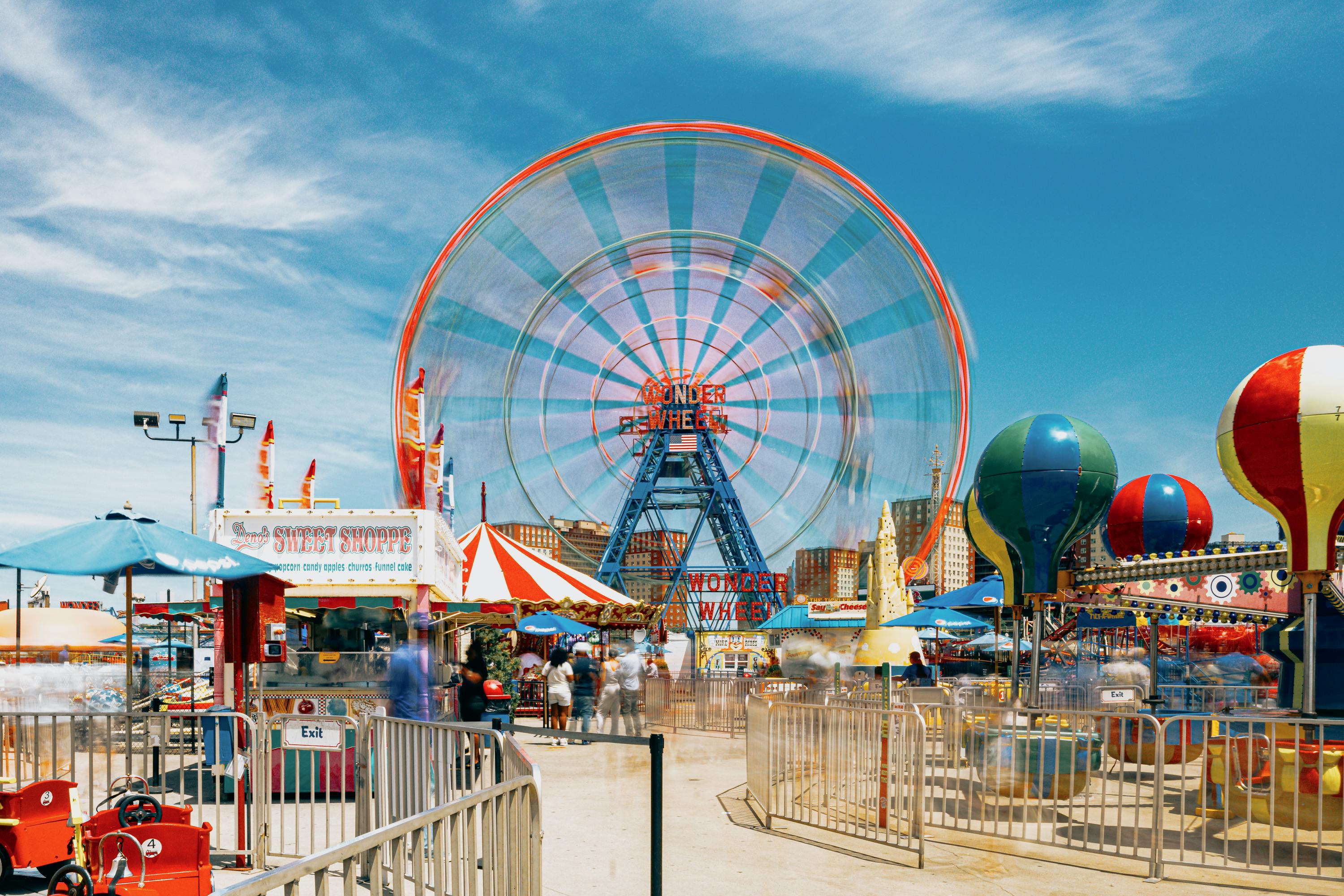
Southern Classics: Coney Island and Nearby Highlights
Coney Island remains Brooklyn’s most nostalgic destination, offering beaches, boardwalk rides, and classic food stops. It is easily accessible by direct subway lines and works well as a half-day or full-day trip. Nearby neighborhoods like Brighton Beach add cultural depth, while stops such as Green-Wood Cemetery provide a striking contrast with peaceful landscapes and historic views.
Practical Tips for Using This Brooklyn Tourist Map in 2025
Use real-time transit apps for subways and buses, consider Citi Bike for short hops, and check ferry schedules for scenic alternatives. Comfortable walking shoes and flexible timing make a big difference. Weekends bring markets and performances, especially near Prospect Park, so plan accordingly if you prefer quieter hours.
Make Prospect Park Stays Your Brooklyn Base
Prospect Park Stays short-term rentals near the 16th Street entrance in Windsor Terrace are ideally positioned for this 2025 Brooklyn tourist map. Guests enjoy fast access to Prospect Park, straightforward subway connections to every major cluster, and a comfortable home base for planning and unwinding. With attractions grouped logically and travel kept simple, exploring Brooklyn becomes relaxed, efficient, and genuinely enjoyable.
By Prospect Park Stays | Short-term rentals near Prospect Park on 16th Street in Windsor Terrace, Brooklyn